Spectacular coastal walking on Flinders Island | Andrew Bain
Blog home / Traveller stories: Hiking on Flinders Island
The edited article below was written by Andrew Bain for Traveller who was a guest on the Flinders Island Walking Adventure. You can read his full Flinders Island experience here.
The bar has been set high. "I reckon this is the best bit of coastal walking I've seen anywhere in the world," says guide Ben as he outlines the day ahead on a map.
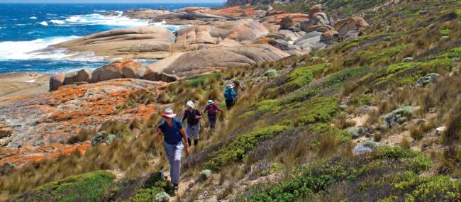
It's a day that will see us rounding rocky, ocean-beaten shores on the west coast of Tasmania's Flinders Island. The scoured granite cliffs of Mount Killiecrankie will tower overhead, boulders will balance on boulders in defiance of gravity, and there will be a beach that might have been transplanted from a Thai island.
It could indeed be one of the most beautiful coastal walks in the world, but then again it might not even be the most beautiful walk on Flinders Island.
Propped like a barrier at one end of Bass Strait, Flinders Island is a striking piece of the land bridge that once joined Tasmania to mainland Australia.
Framed in beaches, with mountains seeming to bubble up from its shores, it's the largest island in Bass Strait – twice the size of Singapore – and yet it's home to fewer than 1000 people.
This emptiness is one of the island's greatest attractions, and the hiking potential is massive and, until recently, largely untapped.
It has a disproportionate number of Tasmania's listed 60 Great Short Walks – three are on Flinders – and at least three adventure-travel companies have recently started hiking tours to the island. I've come on the first trip run by Tasmanian Expeditions.
It's our second day on the island as we set out around the toes of Mount Killiecrankie with Ben's promise sounding in my ears. It's not the only noise here though, as relentless winds screech ashore on this island that straddles the line of the notorious Roaring Forties.

We set out walking this day from the Dock, a gloriously empty bay that could fill postcard stands with its cinematic landscape of rock spires rising from the beach. Highest of all is Mount Killiecrankie.
There are rocks sliced like toast, great walls of pitted granite, and lichen-smeared rocks textured and coloured like the rind of an orange. The greatest surprise comes as we round the bend into Killicrankie Bay.
Suddenly, gnawed into this violently rocky landscape is Stacky's Bight, a protected cove nestled into the base of the cliffs below the track.
We descend to the sands for lunch and a swim in the crystalline waters. A limestone arch splits the cove into two gorgeous beaches.

The sand is almost the colour of butter, and the well-named Old Man's Head rock tower peeps up behind to complete a perfect picture. It could easily be some tropical paradise, if you ignore the water temperature.
To contest Ben's claim about world-topping coastal walking, we need only head a few kilometres south, where another day we set out on foot for Castle Rock, one of Tasmania's Great Short Walks.
Most of this walk is trackless, for the pure fact that most of it is along beaches – a succession of sandy strips partitioned by dramatic granite headlands. It's hard to imagine more beautiful beaches and yet, except for our group of hikers, they're entirely empty.
Marshall Beach is also our approach to camp. Tucked among scrub behind the beach, Tasmanian Expeditions has created a semi-permanent campsite. One step short of glamping, it's still a far cry from a standard pitch-your-own camp.
Tents sit on wooden platforms, with enough room to stand up inside, and each tent contains comfortable stretcher beds. The camp shower is outdoor, using solar-heated bags, and the entire camp is framed around a kitchen tent where guides barbecue up high-quality meals sourcing as much local produce as possible – this trip we dine on the likes of salmon fillet with lemon and garlic, and chicken marinated with lemon thyme.
Each morning we drive to a new location and a new walk – trails are never hard to find since the long-distance Flinders Trail runs around the circumference of the island.
This particular evening, after wandering in from Castle Rock, we also drive out to nearby Wybalenna for a reminder that not everything on Flinders Island has always been about beauty. There was also cultural brutality.
In 1834, 135 Tasmanian Aboriginal people were rounded up and sent to this wind-blasted headland. By the time they were shifted to Oyster Cove 13 years later, only 47 had survived the attempt to "civilise" them.
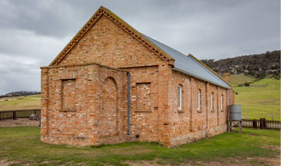
What remains today is Wybalenna's red-brick chapel, sitting alone in grassland beside a cemetery of unmarked Aboriginal graves (and the graves of a few early European settlers).

Down the slopes beside Wybalenna is Lilies Bay, where both the pylons of an abandoned jetty and the distant tall tips of the Strzelecki Peaks, Flinders Island's highest mountains, spear out of the sea.
As I stand on its shores, a large ray glides away, and a lone dolphin surfaces and disappears a few hundred metres out to sea. It's pretty much the perfect end to a hiking day.
Read Andrew Baine's full account at traveller.com.au
EXPERIENCE IT